On August 13th, 2011, I decided to set off and look for a crashed Lockeed Ventura from 1944. It was a crazy idea being as it was so late in the day and I'm 80 or so km away from the start of the logging road which eventually takes you to the site...albeit up a very steep trail. But the result was challenging, great fun, and very moving at the same time. Filling up in Nanaimo, I headed on.
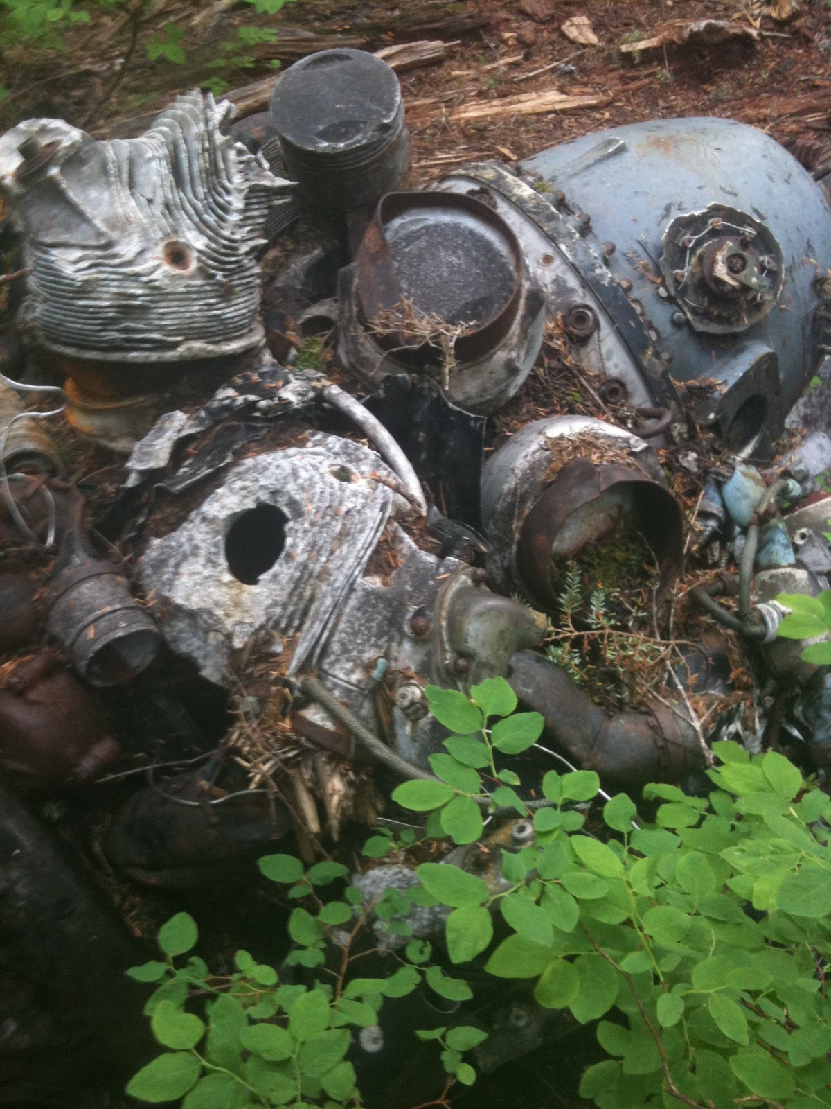
During World War II on April 25, 1944 a Lockheed Ventura Coastal Patrol Plane with a crew of 6 became disoriented on a flight from Patricia Bay to Tofino. The plane crashed on Mt. Bolduc with no survivors. A cairn located nearby marks the grave and records the names of the crew, who were all found in and around the smouldering wreckage, albeit dead from the trauma of the impact. You can read more details about the crash and the attempts by the locals to find the "survivors" from the original story taken from the Cowichan Leader, dated May 1, 1944.
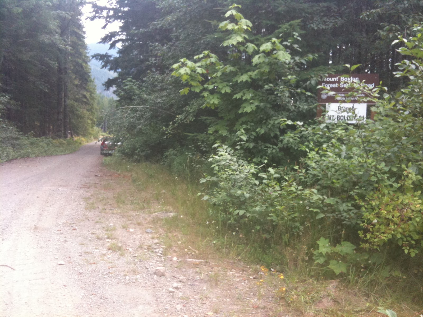
Getting to Gordon River and taking the left soon gets you to this sign where you take a right fork.
Above: This is the trail you will follow nearly all the way to the top of Mt. Bolduc. The views and terrain are stunning along the way. Because of some of the grades, I was really happy with the grunt of Suzi Q...
Above: You're heading up that valley. The road is fairly level here, with nice crush and easy riding. That will change...but not drastically enough to deter this novice...
You can see the valley behind that you have meandered up. The road surface is still great; the grades not too bad either. But don't get a puncture, there is no cell reception...at all.
6km up, the Grade is getting gradually steeper, and the cribbing is there to stop the boulders. The road itself is cribbed as the drop off is quite steep.
The grade is starting to steepen. Just ahead the surface deteriorates and there is a hairpin turn with a much steeper grade. This is where I'm glad I've got a torque-monster and nobblies...You can go slow enough not to slide out of the turn, while maintaining enought traction to defy gravity... Keep yer feet on the pegs and your bum in the air. Lean forward!
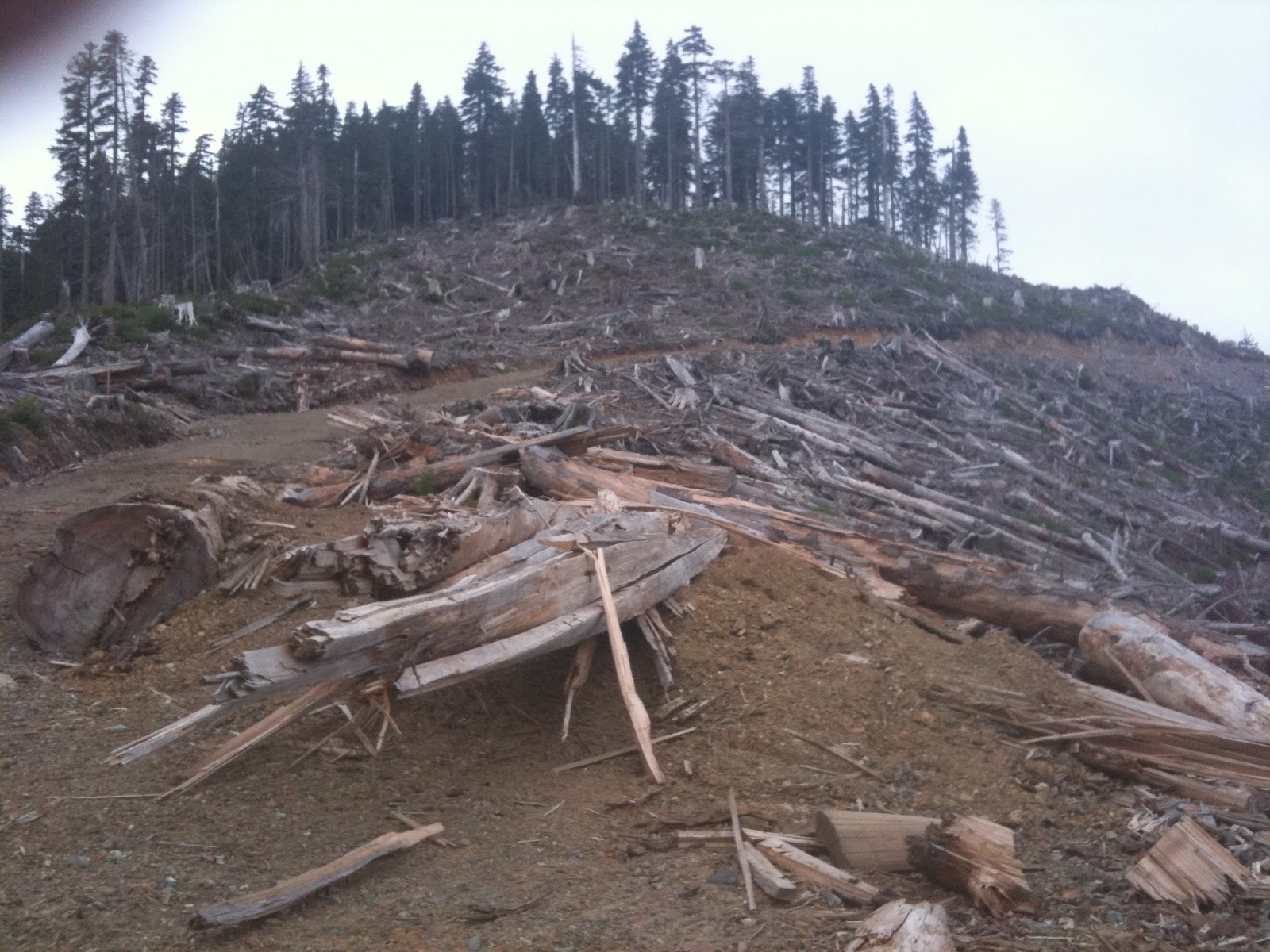
When you get to the end of that road, know that you have gone too far! You're at the summit. Walk up and get a fabulous panoramic view - you're at well over 3000 feet. There's likely snow on the north slopes of the hills around you - in August...
As you can see it was getting late...But I hadn't found the wreck yet...Heading down, I was cognizent that I was alone, there were bears everywhere and I had no cell reception. Quit and go home? No!
The cross which marks the beginning of the crash site, is just in from the road, by a tree with a faded blue and a faded orange ribbon tied around it. They're hard to spot if, like me, you're concentrating on traversing the freshly blasted boulder crush they've used to construct the road in this section. The loggers have refused, out of respect, to log this area. What you are seeing is original growth forest. This makes the crash site - 30 seconds walk from here - a reverent and moving place, set in, if you like, a natural cathedral-like atmospheric situation. The cloud-mist adds to the moving atmosphere of the hallowed ground. And it is hallowed ground (the sign below makes that plain, apologies for the crappy resolution):


The Ventura is scattered in roughly a straight line from the top of Mt. Bolduc through to just near the road. It is a testament to the respect shown by visitors that nothing has been defaced or disturbed (unlike the Tofino Canso Crash site...). I'm not going to blather on anymore, I'll just leave you with the photos, and say it was an amazing day.
Look for the ribbons where the crush ends on the left...


I've been re-reading this one. Feel like going back? I'd really like to see it.
ReplyDeleteYes, let's do it!...2018
DeleteYes: we've got to do it. Perhaps combine it with a camping trip at Nixon creek so we can see some more stuff too: Flora Lake crash of a liberator is west of there. Definitely a trip to do.
ReplyDeleteThank you for posting the pictures. Ambrose Moynagh was my uncle, and died in this plane crash. Just tonight I discovered these pictures. My mother (Ambrose's sister) lives with me, and she is ninety. She has never seen the location where her beloved brother rests. I will show her tomorrow. Thank you again.
ReplyDeleteShawn, thanks for the message. I'm so pleased that you could see the site, even if it is only through some snaps. It amazes me that you are Ambrose's nephew and his sister - your mother - is still alive. I can tell you that the site is very moving. It is very remote and has a real presence, just like a cathedral would. The trees are huge, and being so high up in elevation it's often misty. The locals, when they can, will drive up on November 11th (if it isn't too snowy) and place poppies on the tree by the plaque. Amazingly, it is the young people of Honeymoon Bay who are most moved by it, and the four people I met later had been up to see it the week before and knew all about the history of the crew and plane. I will go up again next summer, and post some more pictures.
ReplyDeletePaul
We just attempted this ride today, from Victoria. The steep section you mention has had a washout in the recent past, and was too much of a challenge for us to ride. It was very steep, and extremely loose, sharp rocks. We did walk up, but couldn't see any ribbons, or signage. Will try it again, sometime soon.
ReplyDeleteHi Donna, thanks for the comment. Where about was the washout? There's a geocache up there too, and I got quite a few comments about 3 weeks ago from GCachers who made it (probably 6 or so). Wonder if you took a wrong turn or the washout was recent? Thanks for the comment. Join us at "The Real Motorcycle Diaries" now. This Blog is no longer updated. Cheers Paul
DeletePaul, Can you give me an idea how long the return trip is. This ride has been on my list for a couple of years now and I have a friend coming up from the states in October who I would like to take with me.
ReplyDeleteDepends where you're starting from. If from Victoria, then it may be prudent to plan on an extremely early start. I came from Nanaimo, leaving in early mid afternoon, and getting back around 9pm...
ReplyDelete